لأستكشاف جغرافيا الأرض وخرائط دول العالم الجيولوجيه
Global Mapper 11.1
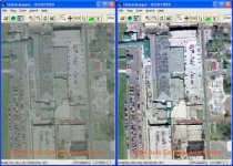
برنامج لأستكشاف جغرافيا الدول والعالم والبراري والمدن والأنهار وقياس البعد الحقيقي من نقطة الى نقطه..مثل من بيتك الى بلدة في جنوب البرازيل بدقة عالية
هام بالتأكيد لكل باحثه او معلمه..او طالبه محب للجغرافيا واستكشاف الخرائط
Global Mapper is more than just a utility; it has built in functionality for distance and area calculations, raster blending, feathering, spectral analysis and contrast adjustment, elevation querying, line of sight calculations, cut-and-fill volume calculations, as well as advanced capabilities like image rectification, contour generation from surface data, view shed analysis (including Fresnel) from surface data, terrain layer comparison (including differencing), and triangulation and gridding of 3D point data. Repetitive tasks can be accomplished using the built in scripting language or comprehensive batch conversion functionality.
Have you ever received a dataset that does not match the projection of your current project? Simply load the dataset into Global Mapper, change the projection, and save the file to match your coordinate system. If the dataset is larger than the area you are interested in, export the data using the crop feature and change the projection and format of the data at the same time.
Your data files can be loaded as layers, for example a Digital Elevation Model (DEM) can be loaded with a scanned topographical map to create a 3D view of the map. A digital aerial image can be draped on the surface together with vector contour mapping to create a stunning and informative graphic. The results can be printed, or the workspace can be exported to a high resolution raster image for use in a presentation or report.
Provides direct access to DigitalGlobe high resolution color imagery and OpenStreetMap.org detailed street maps for the entire world from within the application!
Provides direct access to the complete TerraServer-USA satellite imagery and topographic map archive for the entire US free-of-charge within the application!
Provides easy, direct access to WMS data sources, including built-in access to the complete 30-m NED database, the 3-arc second world SRTM database, and color global Landsat imagery free-of-charge within the application!
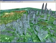
Supports true 3D viewing of loaded elevation data including draping of any loaded imagery and vector data over the 3D surface.
Crop, reproject, and merge any combination of raster data and elevation data, including DRGs. You can also crop data to an area feature.
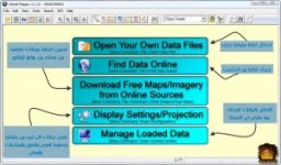
واجهة البرنامج :
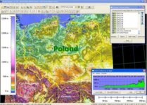
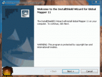
تثبيت البرنامج كما في الصورة المتحركة التالية :/
لتحميل البرنامج :
http://plusshare.net/7cmmdf2qjkcg/glomap111.rar.html
--
الموضوع منقول بتصرف من MR.MILE
فشكرا جزيلا له
Global Mapper 11.1

برنامج لأستكشاف جغرافيا الدول والعالم والبراري والمدن والأنهار وقياس البعد الحقيقي من نقطة الى نقطه..مثل من بيتك الى بلدة في جنوب البرازيل بدقة عالية
هام بالتأكيد لكل باحثه او معلمه..او طالبه محب للجغرافيا واستكشاف الخرائط
Global Mapper is more than just a utility; it has built in functionality for distance and area calculations, raster blending, feathering, spectral analysis and contrast adjustment, elevation querying, line of sight calculations, cut-and-fill volume calculations, as well as advanced capabilities like image rectification, contour generation from surface data, view shed analysis (including Fresnel) from surface data, terrain layer comparison (including differencing), and triangulation and gridding of 3D point data. Repetitive tasks can be accomplished using the built in scripting language or comprehensive batch conversion functionality.
Have you ever received a dataset that does not match the projection of your current project? Simply load the dataset into Global Mapper, change the projection, and save the file to match your coordinate system. If the dataset is larger than the area you are interested in, export the data using the crop feature and change the projection and format of the data at the same time.
Your data files can be loaded as layers, for example a Digital Elevation Model (DEM) can be loaded with a scanned topographical map to create a 3D view of the map. A digital aerial image can be draped on the surface together with vector contour mapping to create a stunning and informative graphic. The results can be printed, or the workspace can be exported to a high resolution raster image for use in a presentation or report.
Provides direct access to DigitalGlobe high resolution color imagery and OpenStreetMap.org detailed street maps for the entire world from within the application!
Provides direct access to the complete TerraServer-USA satellite imagery and topographic map archive for the entire US free-of-charge within the application!
Provides easy, direct access to WMS data sources, including built-in access to the complete 30-m NED database, the 3-arc second world SRTM database, and color global Landsat imagery free-of-charge within the application!
Supports true 3D viewing of loaded elevation data including draping of any loaded imagery and vector data over the 3D surface.
Crop, reproject, and merge any combination of raster data and elevation data, including DRGs. You can also crop data to an area feature.
واجهة البرنامج :


تثبيت البرنامج كما في الصورة المتحركة التالية :/

لتحميل البرنامج :
http://plusshare.net/7cmmdf2qjkcg/glomap111.rar.html
--
الموضوع منقول بتصرف من MR.MILE
فشكرا جزيلا له
