This is the first in a series of posts about a side project I’ve been developing and maintaining for the past few years. This introduction will be accompanied by subsequent posts dealing with the technical, commitment, and emotional issues associated with running a project on the side.
Back in 2009, I moved down to Glassboro, New Jersey to be close to work. I had spent that summer contributing to OpenStreetMap and wanted to spend more time working with local data. In searching for a new home, I wanted to use property information and other points-of-interest data to get (re)acclimated to the area.
At the time, I recall web GIS falling into two categories: Google Map mashup or ArcIMS/ArcGIS Server desktop-on-the-web GIS. Typically, the map mashups were tailored to a specific region or data set. The clunky web viewers set up by county and regional governments had valuable data, but an absolutely abysmal user experience.
So, in the Summer of 2009, I planned on making a web site with some local GIS data for Gloucester County. I originally planned to pull in information from OSM and other sources to paint a picture of the community, highlighting what would be most useful to someone considering moving to or visiting the area. Setting it up on Dreamhost shared hosting, I eventually bought GlassboroMap.com that fall and began building a web map, starting with property information for the County.
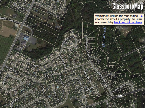 GlassboroMap.com – perpetually in beta
(...)
Read the rest of Update on a side project on my blog.
© John Reiser for new jersey geographer, 2016. |Permalink |No comment |Add todel.icio.us
Post tags: business, GIS, NJ Parcels, postgis, projects, Web Mapping
أكثر...
Back in 2009, I moved down to Glassboro, New Jersey to be close to work. I had spent that summer contributing to OpenStreetMap and wanted to spend more time working with local data. In searching for a new home, I wanted to use property information and other points-of-interest data to get (re)acclimated to the area.
At the time, I recall web GIS falling into two categories: Google Map mashup or ArcIMS/ArcGIS Server desktop-on-the-web GIS. Typically, the map mashups were tailored to a specific region or data set. The clunky web viewers set up by county and regional governments had valuable data, but an absolutely abysmal user experience.
So, in the Summer of 2009, I planned on making a web site with some local GIS data for Gloucester County. I originally planned to pull in information from OSM and other sources to paint a picture of the community, highlighting what would be most useful to someone considering moving to or visiting the area. Setting it up on Dreamhost shared hosting, I eventually bought GlassboroMap.com that fall and began building a web map, starting with property information for the County.
GlassboroMap.com – perpetually in beta(...)
Read the rest of Update on a side project on my blog.
© John Reiser for new jersey geographer, 2016. |Permalink |No comment |Add todel.icio.us
Post tags: business, GIS, NJ Parcels, postgis, projects, Web Mapping
أكثر...