
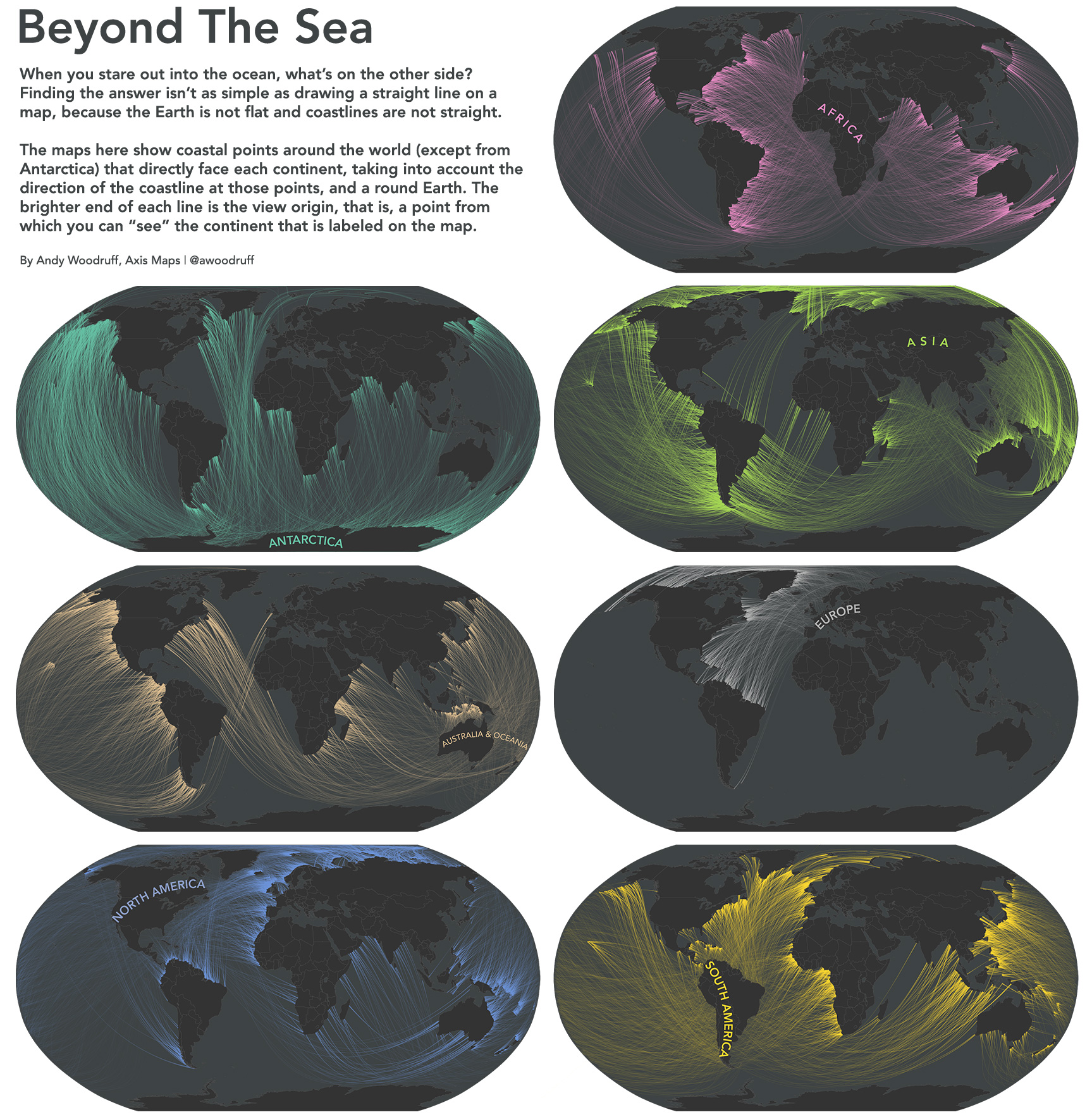
Have you ever wondered what is location on the other side of the sea, when looking deep into the horizon on the seaside? You might think that it’s quite easy to figure out but you need to remember that the cost line is not straight and therefore when*standing perpendicular to the ocean at Long Island you might be actually looking at south cost of Australia rather than Portugal (if it’s hard to imagine play around with Google Earth).
Andy Woodruff*a cartographer from*Axis Maps*decided to map it. He started with determining the direction of each point of the each coastline. Than he traced a “great circle” (a “line” along the surface of a sphere, starting and ending at the same point) trough each of these points and clipped it with land masses.
The effect is really mind bending and I must say that I had to spend some time with Google Earth to really believe*it. It made me realize how much our image of the word has been distorted by inappropriate usage of Mercator project.

Take a look at maps for other continents.
The post This maps show exactly what is located on the other side of the ocean appeared first on Geoawesomeness.