This is a QGIS vs. ArcGIS throwdown. It has been a while since I did the last one on
kernel densityand Thiessen polygons. Recently, I was looking over new QGIS plugins and one in particular caught my eye: the
QGIS Magnetic Declination Plugin.
Magnetic declinationis simply the difference between geographic and
magnetic north, caused by the earth's magnetic fields.This difference also changes over time. ESRI has a nice
technical article on their blog.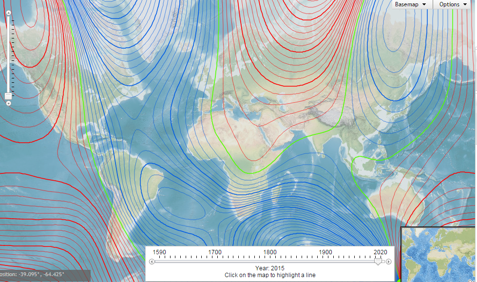 NOAA Historical Magnetic Declination Viewer:
http://maps.ngdc.noaa.gov/viewers/historical_declination/ArcGIS
Adding a declination diagram in ArcGIS can be a bit tricky. As of version 10.2, there is a template and several tools to assist. You will need a Standard or Advanced license plus the Production Mapping Extension.
QGIS Plugin
 On main toolbar in QGIS, go to Plugins-->Manage and Install Plugins--> and search for Magnetic Declination. After a quick installation, you will see a green and yellow star appear on your toolbar. Click it and you will see the toolbar open below.
 You can select a location off a map, such as OpenStreetMap, calculate it and map it! Best of all, the resulting compass rose and measurements also appear in QGIS Print Composer. Under the options tab, you can also change the color. I found it helpful to change it to black.
Steps:
- Click LON/LAT from map
- Choose any options
- Press "Calculate" button
- Then "Draw Compass Rose"
 Screenshot of the plugin, steps, and buttons.
- Click any of the screenshots below to get a closer look.
 Up close example with declination, true, and magnetic north shown in Greenland
where declination is much greater.
 Showing positive, zero, and negative declination in the US.
The plugin is very new but is being updated, so stay tuned!
أكثر...