 2013 was a great year and the SARGIS Membership has grown to +500 members!
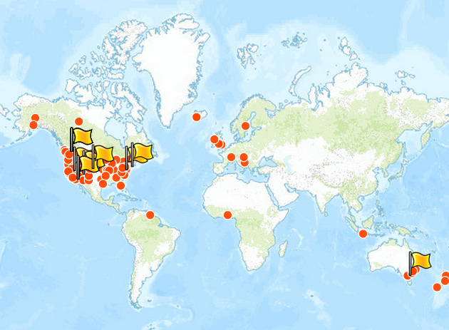
 See the live map and add yourself by entering your coordinates.
Let's take a look at some highlights from 2013 (let me know what I missed):
January the GISCorps began a pilot project to train their members in MapSAR and ArcGIS for WiSAR
February Great discussion on the use of timelines in SAR planning
March IGT4SARTabletop exercise and training in Morgantown, West Virginia - Jared Doke released his MS Thesis on Lost Person Behavior in Yosemite - GISCorps MapSAR Training in San Jose, CA
April - 5th Annual SARGIS Meeting in Denver, Loren Pfau presented on his graduate work - MapSAR Training in Bellevue, Washington - Don Ferguson gave a lecture on SARGIS at George Mason University
May Paul Doherty defended (successfully) a SARGIS dissertation at UC Merced
June Rick Laing shared his research on Missing Person Data for Alzheimer Patients in British Columbia. Sierra Madre SAR teaches MapSAR at the MRA Conference in Arizona.
July the second SARGIS User Group meeting was held at the Esri International User Conference
August NAPSG SARGIS Training in Connecticut
September SARGIS is presented at AFAC2013, Melbourne Australia - MapSAR is adapted by NSW and Victoria Rescue teams in Australia. Sierra Madre SAR teaches MapSAR at SAREX in Santa Cruz County, California.
October MapSAR is updated for 10.2 - MapSAR Training & Presentation at SARScene2013 in Chiliwack Canada
November Training videos for IGT4SAR and MapSAR are released. George Durkee taught online classes at Columbia College (GIS Essentials for SAR and Agency Operations) and hands-on coursework as well.
<div>December CalOES agrees to recognize the GISCorps MapSAR Trained volunteers as State mutual aid resources! There will be a swearing in, early 2014.
 Marcus Kitchens and myself standing in front of Don Ferguson's Travel Cost poster at the Esri UC
Finally, many of you were involved in supporting SAR missions on-site (US, Canada, and Australia) and remotely. Some of note are the Conn, Greene, and Lagrée.
What would you like to see in search and rescue GIS in 2014?
<div><ul>Organization: A more formal SARGIS organization? A non-profit body? Or continue to remain a discussion group?
Training: More on-site training? More online training? More training videos? More training manuals? More Field Guides / SOPs?
Discussion Group: Would you like to remain on the Google Group discussion list serv? Any suggestions for another forum?
Platform: As we see more use of web mapping and ArcGIS Online in emergency management, is that something you all want to know more about? How about connected / disconnected workflows? The integration of other devices?
Assistance: Should we continue to discuss active search operations in the Discussion portal? If so - should we assign roles to make sure information is kept clear and concise?
Research: There are many great research activities going on? How should we continue to formalize this and make sure the link between academia / field is strengthened?
<span style="font-family: Verdana, sans-serif;">Annual Meeting: Where shall the 2014 SARGIS Meeting be held? Remember our spatial requirements (