 They are even making maps during the football game!!!
We are here at the MapSAR Training at New Mexico State University, Las Cruces. The class had about 20-25 participants total and we kicked it off with a public colloquium on Friday night. Then on Saturday we walked through MapSAR tutorials using a missing person search scenario in Yosemite National Park. On Sunday we finished up the lessons and repeated them using local New Mexico data to reinforce the elements learned in the tutorial. The class had a great mix of SAR volunteers, GIS students, and some people who have done both SAR & GIS.
So, because it went so well, I thought I would take a moment to document some resources for the students and those who could not make it today.
Base Data
The Boundaries folder for instance has Wilderness Boundary layers available for download. The Transportation folder contains datasets like the Continental Divide Trail. Vector datasets like these should be downloaded as shapefiles and added to ArcMap.
Aerial imagery is available in the Digital Orthophotography folder and elevation data (Digital Elevation Models) in the Elevation folder. For instance, here is a statewide 60m DEM. There are also 7.5' USGS Topographic maps available in the Topographic folder. Raster datasets like these come in a variety of data formats including .tif, .sid, etc. Read up on adding raster data to a map.
Just in case you need a refresher on vector vs raster....
Vector Data
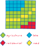
A coordinate-based data model that represents geographic features as points, lines, and polygons. Each point feature is represented as a single coordinate pair, while line and polygon features are represented as ordered lists of vertices. Attributes are associated with each vector feature, as opposed to a raster data model, which associates attributes with grid cells.
Raster Data
 A spatial data model that defines space as an array of equally sized cells arranged in rows and columns, and composed of single or multiple bands. Each cell contains an attribute value and location coordinates. Unlike a vector structure, which stores coordinates explicitly, raster coordinates are contained in the ordering of the matrix. Groups of cells that share the same value represent the same type of geographic feature.
 Definitions from the GIS Dictionary
For more tips and tricks, see the chapter on creating a Minimum Essential Dataset for your response area, see the Using GIS for Wildland Search and Rescue eBook.
GIS Training
Esri Training (training.esri.com)
- Getting started with GIS (free 4-hour online course)
- ArcGIS 1: Introduction to GIS (2-days with Instructor)
- GIS Course Listing
- New Mexico State University Geography Department
- Central New Mexico Community College
Here are some resources for getting help with MapSAR, IGT4SAR, and ArcMap.
- MapSAR Training Videos
- IGT4SAR Training Videos
- ArcGIS Help
- ArcGIS for Emergency Management
- GIS Stack Exchange
Here are some of the topics that came up during the class that we would like to open up to the community.
- Integration of SAR Theory into GIS
- Assignment versus Segments
- Making maps for mobile via pdf
- Real-time GIS (Integration APRS, ArcGIS Online with Collector)
- State-wide SAR Minimum Essential Dataset
- Pre-planning Search Segments (see blog post)
- Fast Basemaps (see blog post)
- Beyond MapSAR (Analysis tools using DEM such as slope, viewshed, elevation profile, etc)
- Dr. Michaela Buenemann & New Mexico State University Geography Department and New Mexico SAR Council for hosting this event
- Jon Pedder and the Sierra Madre SAR Team for developing MapSAR
- NAPSG Foundation for sponsoring the event
- Lorri Peltz-Lewis and the GISCorps for their continued support
Stay tuned...
- The training materials will be posted as soon as we have incorporated feedback
- We will use this as a template to help other instructors teach this in their own community
- Teaming up with a local University has proven to be a great way to introduce GIS experts and SAR Teams!
View Larger Map
أكثر...

