REMOTE SENSING & GIS FOR PLANNING STUDIES

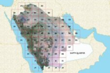
This paper briefly reviews the experiences using Remote Sensing and GIS capabilities for planning studies in the case of Deputy Ministry for Town Planning (DMTP) of Ministry of Municipalities and Rural Affairs (MOMRA) Kingdom of Saudi Arabia. The core issue in this paper is how to use Remote Sensing and GIS capabilities for the establishment of the data, which will be used for planning studies evolved over the period. This technology briefly introduced and elaborated on the project called "Structural Plan Follow-up Project" in this paper.
Dr. Talat EKSIOGLU
P.O. Box 53179, Riyadh 11583, KSA
--
Haitham Elwany
---------------------------
