LP360 for ArcGIS™

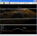
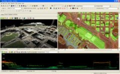
LP360 for ArcGIS™ is a first-of-its-kind LIDAR software extension for the ESRI™ ArcGIS environment. The LP360 LIDAR extension uses a specially-designed ArcMap™ data layer to access points directly from industry standard LAS files. LP360 completely integrates LIDAR point cloud datasets into ArcGIS without requiring an import or conversion process. With LP360 LIDAR data can be combined with data in any format supported by ArcGIS.
LP360 for ArcGIS is easy to operate and makes using LIDAR data in ArcGIS easy. LP360 for ArcGIS is incredibly fast, not RAM sensitive, and includes a large suite of innovative tools. LP360 for ArcGIS is the easiest, fastest, and most powerful way for GIS professionals to use LIDAR in ArcGIS.
LP360 for ArcGIS includes a powerful Point Cloud Task framework. The Point Cloud Task framework is a user friendly interface for generating point cloud statistics and previewing basic classification filters, height from surface filters, height filters, building point classification, building outlines, and macro filter stacks.


Benefits and Features
Virtually limitless LIDAR data architecture
Leverages the LIDAR industry/ASPRS LAS standard (1.0, 1.1, and 1.2)
Integrated extension for ArcMap™
Requires only a standard ArcView™license
Creates a LIDAR data layer in ArcMap™
End-user focused with easy-to-use controls
Blends imagery or other data layers with LIDAR
Specialized viewing controls and filters tailored for LIDAR data
Blazing fast on-the-fly contouring and tinning
Optimized cross-section/profile data viewer
3D data viewer
Exports customizable contours, surfaces and point formats
Point Cloud Tasks, including statistics
Export wizard (customizable point and surface utilities)
ASCII points to LAS converter
GIS Fusion™
Optional Classify and Extractor modules available
More About LP360
Introduction to LP360: Video Presentation
Try 30-day Evaluation
LP360 for ArcGIS is tightly integrated into the ArcGIS environment and provides superior performance even when run with the largest of LIDAR data sets. LP360 for ArcGIS can handle gigantic LIDAR dataset. Try the free evaluation now and experience the benefits of LP360 and Limitless LIDAR™.
حمل نسختك
Download Evaluation
http://www.qcoherent.com/evaluation.html
(يجب التسجيل اولاً قبل البدء فى التحميل)
Documentation
Getting Started with LP360
LP360 Brochure
Available for Purchase
LP360 is available for purchase and includes LP360 for ArcGIS. Floating licensing is available. If you would like to try LP360, please download our 30-day free evaluation.
To purchase, click the buy button or contact our sales department at 1-256-461-8289, or e-mail sales@qcoherent.com.

LP360 for ArcGIS™ is a first-of-its-kind LIDAR software extension for the ESRI™ ArcGIS environment. The LP360 LIDAR extension uses a specially-designed ArcMap™ data layer to access points directly from industry standard LAS files. LP360 completely integrates LIDAR point cloud datasets into ArcGIS without requiring an import or conversion process. With LP360 LIDAR data can be combined with data in any format supported by ArcGIS.
LP360 for ArcGIS is easy to operate and makes using LIDAR data in ArcGIS easy. LP360 for ArcGIS is incredibly fast, not RAM sensitive, and includes a large suite of innovative tools. LP360 for ArcGIS is the easiest, fastest, and most powerful way for GIS professionals to use LIDAR in ArcGIS.
LP360 for ArcGIS includes a powerful Point Cloud Task framework. The Point Cloud Task framework is a user friendly interface for generating point cloud statistics and previewing basic classification filters, height from surface filters, height filters, building point classification, building outlines, and macro filter stacks.


Benefits and Features
Virtually limitless LIDAR data architecture
Leverages the LIDAR industry/ASPRS LAS standard (1.0, 1.1, and 1.2)
Integrated extension for ArcMap™
Requires only a standard ArcView™license
Creates a LIDAR data layer in ArcMap™
End-user focused with easy-to-use controls
Blends imagery or other data layers with LIDAR
Specialized viewing controls and filters tailored for LIDAR data
Blazing fast on-the-fly contouring and tinning
Optimized cross-section/profile data viewer
3D data viewer
Exports customizable contours, surfaces and point formats
Point Cloud Tasks, including statistics
Export wizard (customizable point and surface utilities)
ASCII points to LAS converter
GIS Fusion™
Optional Classify and Extractor modules available
More About LP360
Introduction to LP360: Video Presentation
Try 30-day Evaluation
LP360 for ArcGIS is tightly integrated into the ArcGIS environment and provides superior performance even when run with the largest of LIDAR data sets. LP360 for ArcGIS can handle gigantic LIDAR dataset. Try the free evaluation now and experience the benefits of LP360 and Limitless LIDAR™.
حمل نسختك
Download Evaluation
http://www.qcoherent.com/evaluation.html
(يجب التسجيل اولاً قبل البدء فى التحميل)
Documentation
Getting Started with LP360
LP360 Brochure
Available for Purchase
LP360 is available for purchase and includes LP360 for ArcGIS. Floating licensing is available. If you would like to try LP360, please download our 30-day free evaluation.
To purchase, click the buy button or contact our sales department at 1-256-461-8289, or e-mail sales@qcoherent.com.
