 Beautiful UVA Campus!
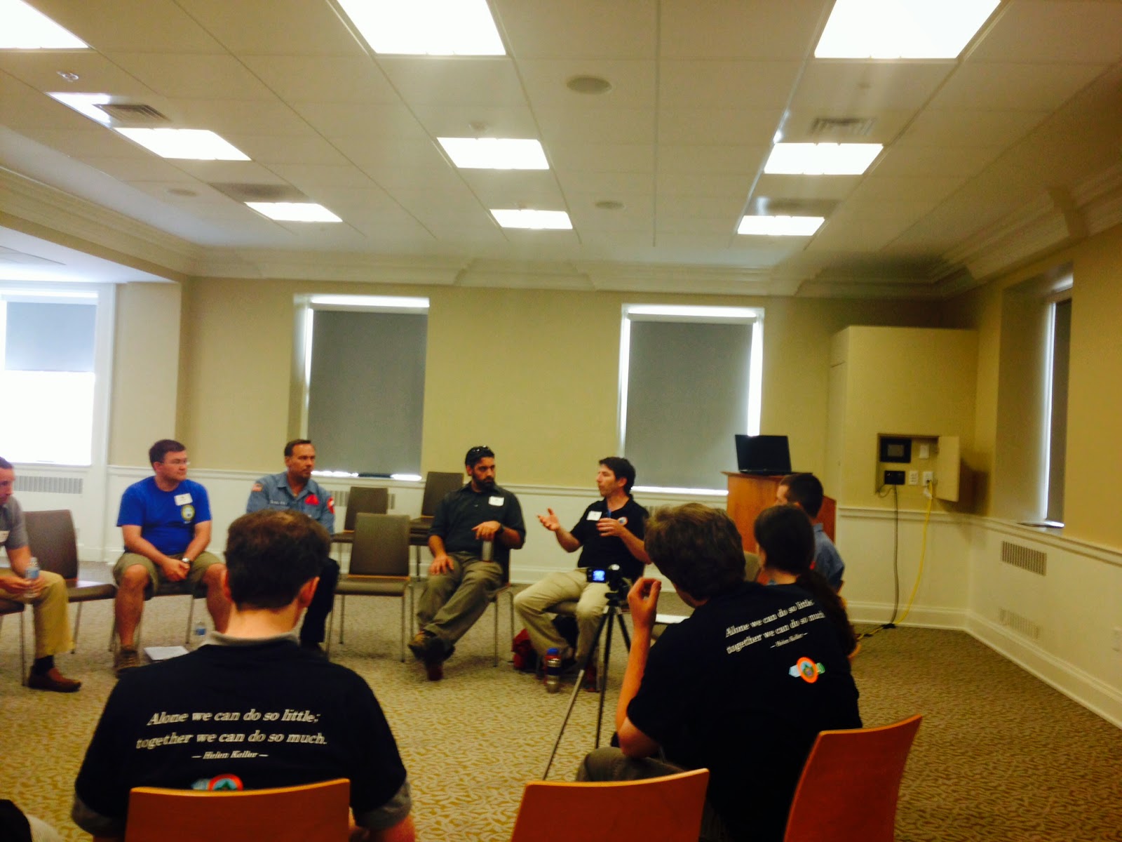 Don Ferguson and Eric Menendez leading a roundtable discussion on remote collaboration for Search Operations and Geographic Information Systems. Don has already experimented using ArcGIS Online and Wikispaces to assist in extended searches. Here at the University of Virginia in Charlottesville, VA there have been some very productive discussions about incorporating GIS into SAR. More than just discussion here are some immediate actions items:
Define protocols for remote collaboration in the Region
Design a catalog of information products that can be requested by search managers ("It should be as simple to follow as a Chinese Food Menu")
Agree on some basic standards of what is required to generate these information products
- Assignment maps
- Briefing maps
- Minimum Essential Dataset packages
- Analysis (e.g. Terrain models, Cell phone analysis, Spatially-enabled probabilities (POA / POD))
More discussions about emerging technology and how they fit in (Cell Phone Analysis, UAVs, etc).
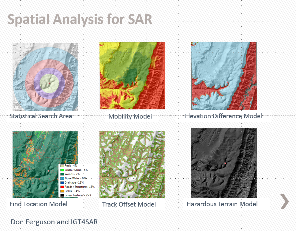 The slides from my plenary talk are available for download from here.
This is the first time I have seen a volunteer community come together to discuss remote collaboration and incorporation into GIS as a platform. It is very impressive and I am hoping the GISCorps members in the region can step in to help.
Other great talking points include:
- Veterans can be extremely valuable in austere disaster response environments, especially if supported with GIS - Lourdes Tiglao, Team Rubicon
- Search Theory will evolve with the use of GIS - Dr. Charles Twardy and Robert Koester
- Stop referring to it as "Lost Person" incidents, rephrase as "missing person" incidents. This will help engage the Law Enforcement Community and see the SAR functions as a great asset. - A State SAR Coordinator
أكثر...