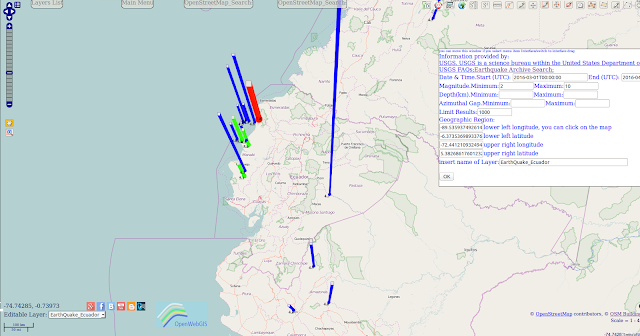
Initial data on earthquake was selected from the database of "Earthquake Archive Search" with the help of menu item in OpenWebGIS: "GeoDataBase-> Earthquakes Database".
For the analysis we choose a rectangle with coordinates:
lower left longitude: -89.53593749261435; lower left latitude: -6.373536989337675; upper right longitude: -72.44121093249441; upper right latitude: 5.382686176012323.
Magnitude range: from 2 to 10.
Date & Time(UTC): from 2016-03-01T00:00:00 to 2016-04-17T10:39:04.
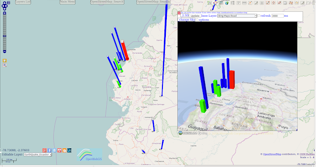
The result of selecting, adding on the map and customizing the legend is shown on Figure 1.
You can analyze this data using all the opportunities of OpenWebGIS if you open this interactive Map.
The analysis of selecting data reflect that a clear foreshock occured at 2016-04-17T01:47:44 with magnitude 4.8 (see Figure 1a) near the place of mainshock which happened later at 2016-04-17T01:58:37.
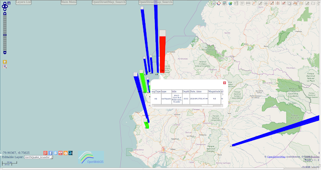
After that there was a set of aftershocks with magnitudes from 4.5 to 5.6 up to 2016-04-17T09:13:58. To show the depth of earthquakes it is possible to use 2.5D columns. Detailed information about using 2.5D columns and customizing the legend can be found in the following articles: "Spatial and temporal distribution of earthquakes in Chile and adjacent areas (1960-2015)" and "Spatial and temporal distribution of earthquakes in the USA and adjacent areas (1950-2015)".
The result of this mapping is shown on Figure 2.The map shown on Figure 2 is available at this link.
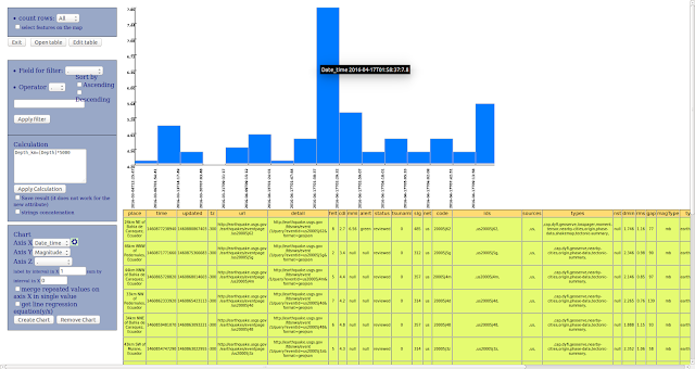
Open the attribute table using the menu item "Edit-> Open attribute table". Then use the function of creation of chart and get a chart of earthquakes magnitudes by times.
The chart of changing magnitudes by times is shown on Figure 3.
To make 3D map of earthquake depth you must click on the button :
in the upper right corner of the map. This button has the title "Add 3d Map. Globe ". There will be a pop-up window in which you can set the desired size of the 3D map area in pixels (see the result on Figure 4).The map shown on Figure 4 is available at this link.
أكثر...


