ASTER SATELLITE IMAGERY
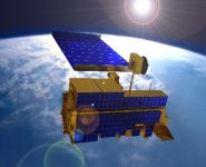
Satellite Imaging Corporation (SIC) acquires ASTER satellite imagery worldwide.
ABOUT ASTER
ASTER is one of the five state-of-the-art instrument sensor systems on-board Terra a satellite launched in December 1999. It was built by a consortium of Japanese government, industry, and research groups. ASTER monitors cloud cover, glaciers, land temperature, land use, natural disasters, sea ice, snow cover and vegetation patterns at a spatial resolution of 90 to 15 meters. The multispectral images obtained from this sensor have 14 different colors, which allow scientists to interpret wavelengths that cannot be seen by the human eye, such as near infrared, short wave infrared and thermal infrared.
ASTER is the only high spatial resolution instrument on Terra that is important for change detection, calibration and/or validation, and land surface studies. ASTER data is expected to contribute to a wide array of global change-related application areas, including vegetation and ecosystem dynamics, hazard monitoring, geology and soils, land surface climatology, hydrology, land cover change, and the generation of digital elevation models (DEMs). Satellite Imaging Corporation (SIC) is an official distributor for ASTER Imagery through USGS.
ARCHIVED AND NEW ASTER IMAGERY
For many image requests, a matching image can already be located in the archives of ASTER imagery from around the world. If no image data is available in the archives, new ASTER satellite image data can be acquired through a satellite tasking process. Besides providing image data, SIC performs many background tasks to ensure that we meet customer specifications and time schedules. Our company:
Negotiates the attainment of images
Processes imagery, including orthorectification, DSMs, DTMs, and raster-to-vector conversions
Provides 3D terrain visualization and modeling for project planning and support
Incorporates third-party U.S.A. and international GIS data
Consults on band combinations most appropriate to bring out the geographical and manmade features that are most pertinent to your project, and performs spectral analysis for land cover/use classifications and environmental changes
For more information and pricing, please contact us.
ASTER SATELLITE SYSTEM: SENSOR CHARACTERISTICS
Launch Date 18 December 1999 at Vandenberg Air Force Base, California, USA
Equator Crossing 10:30 AM (north to south)
Orbit 705 km altitude, sun synchronous
Orbit Inclination 98.3 degrees from the equator
Orbit Period 98.88 minutes
Grounding Track Repeat Cycle 16 days
Resolution 15 to 90 meters
The ASTER instrument consists of three separate instrument subsystems:
VNIR (Visible Near Infrared), a backward looking telescope which is only used to acquire a stereo pair image
SWIR (ShortWave Infrared), a single fixed aspheric refracting telescope
TIR (Thermal Infrared)
ASTER high-resolution sensor is capable of producing stereoscopic (three-dimensional) images and detailed terrain height models. Other key features of ASTER are:
Multispectral thermal infrared data of high spatial resolution
Highest spatial resolution surface spectral reflectance, temperature, and emissivity data within the Terra instrument suite
Capability to schedule on-demand data acquisition requests
ASTER has 14 bands of information. For more information, please see the following table:
Instrument VNIR SWIR TIR
Bands 1-3 4-9 10-14
Spatial Resolution 15m 30m 90m
Swath Width 60km 60km 60km
Cross Track Pointing ± 318km (± 24 deg) ± 116km (± 8.55 deg) ± 116km (± 8.55 deg)
Quantisation (bits) 8 8 12
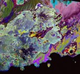
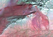
Geology, Yemen
Images are orthorectified and ready to use in your preferred GIS or remote sensing software.
ASTER VNIR - VISIBLE AND NEAR INFRARED
VNIR data at 15m resolution is currently the best resolution multispectral satellite data available commercially, with the exception of very high resolution data like IKONOS or QuickBird.
The VNIR subsystem operates in three spectral bands at visible and near-infrared wavelengths, with a resolution of 15 meters. A comparison with the panchromatic 15m band on the LANDSAT 7 ETM+ data shows that ASTER imagery is better both spatially and spectrally.
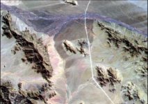
ASTER SWIR - SHORTWAVE INFRARED
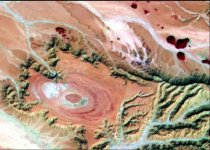
ASTER TIR - THERMAL INFRARED
ASTER SATELLITE IMAGERY GALLERY
For ASTER sample images, please visit the ASTER Gallery.
--

Satellite Imaging Corporation (SIC) acquires ASTER satellite imagery worldwide.
ABOUT ASTER
ASTER is one of the five state-of-the-art instrument sensor systems on-board Terra a satellite launched in December 1999. It was built by a consortium of Japanese government, industry, and research groups. ASTER monitors cloud cover, glaciers, land temperature, land use, natural disasters, sea ice, snow cover and vegetation patterns at a spatial resolution of 90 to 15 meters. The multispectral images obtained from this sensor have 14 different colors, which allow scientists to interpret wavelengths that cannot be seen by the human eye, such as near infrared, short wave infrared and thermal infrared.
ASTER is the only high spatial resolution instrument on Terra that is important for change detection, calibration and/or validation, and land surface studies. ASTER data is expected to contribute to a wide array of global change-related application areas, including vegetation and ecosystem dynamics, hazard monitoring, geology and soils, land surface climatology, hydrology, land cover change, and the generation of digital elevation models (DEMs). Satellite Imaging Corporation (SIC) is an official distributor for ASTER Imagery through USGS.
ARCHIVED AND NEW ASTER IMAGERY
For many image requests, a matching image can already be located in the archives of ASTER imagery from around the world. If no image data is available in the archives, new ASTER satellite image data can be acquired through a satellite tasking process. Besides providing image data, SIC performs many background tasks to ensure that we meet customer specifications and time schedules. Our company:
Negotiates the attainment of images
Processes imagery, including orthorectification, DSMs, DTMs, and raster-to-vector conversions
Provides 3D terrain visualization and modeling for project planning and support
Incorporates third-party U.S.A. and international GIS data
Consults on band combinations most appropriate to bring out the geographical and manmade features that are most pertinent to your project, and performs spectral analysis for land cover/use classifications and environmental changes
For more information and pricing, please contact us.
ASTER SATELLITE SYSTEM: SENSOR CHARACTERISTICS
Launch Date 18 December 1999 at Vandenberg Air Force Base, California, USA
Equator Crossing 10:30 AM (north to south)
Orbit 705 km altitude, sun synchronous
Orbit Inclination 98.3 degrees from the equator
Orbit Period 98.88 minutes
Grounding Track Repeat Cycle 16 days
Resolution 15 to 90 meters
The ASTER instrument consists of three separate instrument subsystems:
VNIR (Visible Near Infrared), a backward looking telescope which is only used to acquire a stereo pair image
SWIR (ShortWave Infrared), a single fixed aspheric refracting telescope
TIR (Thermal Infrared)
ASTER high-resolution sensor is capable of producing stereoscopic (three-dimensional) images and detailed terrain height models. Other key features of ASTER are:
Multispectral thermal infrared data of high spatial resolution
Highest spatial resolution surface spectral reflectance, temperature, and emissivity data within the Terra instrument suite
Capability to schedule on-demand data acquisition requests
ASTER has 14 bands of information. For more information, please see the following table:
Instrument VNIR SWIR TIR
Bands 1-3 4-9 10-14
Spatial Resolution 15m 30m 90m
Swath Width 60km 60km 60km
Cross Track Pointing ± 318km (± 24 deg) ± 116km (± 8.55 deg) ± 116km (± 8.55 deg)
Quantisation (bits) 8 8 12

Geology, Yemen
Images are orthorectified and ready to use in your preferred GIS or remote sensing software.
ASTER VNIR - VISIBLE AND NEAR INFRARED
VNIR data at 15m resolution is currently the best resolution multispectral satellite data available commercially, with the exception of very high resolution data like IKONOS or QuickBird.
The VNIR subsystem operates in three spectral bands at visible and near-infrared wavelengths, with a resolution of 15 meters. A comparison with the panchromatic 15m band on the LANDSAT 7 ETM+ data shows that ASTER imagery is better both spatially and spectrally.

ASTER SWIR - SHORTWAVE INFRARED

ASTER TIR - THERMAL INFRARED

ASTER SATELLITE IMAGERY GALLERY
For ASTER sample images, please visit the ASTER Gallery.
--
