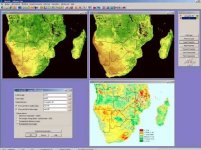
برنامج ER Mapper v.7
برنامج Earth Resource Mapper 7.0 الاصدار السابع مع الكراك.
ER Mapper is an image processing package for earth science and remote sensing applications. It is designed to manipulate large Earth resources data sets, such as satellite, geophysical, seismic and airborne data.
Users can perform complex data integrations and image processing operations on multiple layers and treat them as a real data set. A library of 225 standard algorithms is provided for image enhancement, classification and data fusion. Users can modify and customize these, as well as create new algorithms. ER Mapper can automatically merge, clip, sub-sample, super-sample, rescale and mosaic multiple data sets. Image warping (image to control point, image to image, map to map) and rotation are supported.
Includes a version of ER Mapper's web client/server architecture that delivers raster images over intranets and the Internet
وهذة الروابط
http://rapidshare.com/files/2212602/erMap_RUZ.part1.rar.htm
http://rapidshare.com/files/2216005/erMap_RUZ.part2.rar.html
http://rapidshare.com/files/2209787/erMap_RUZ.part3.rar.html
او على هذا الرابط
Mirror: Download from Depositfiles.com
Part 1
http://depositfiles.com/files/372820
Part 2
http://depositfiles.com/files/372822
Part 3
http://depositfiles.com/files/372823
--
منقول عن
محمد مزاحم


