DigitalGlobe is uploading petabytes of some of the most beautiful imagery we’ve ever seen. With no seams, clouds, or haze, their +Vivid country mosaics cover the majority of the world’s land mass. And there’s a lot more to come from DigitalGlobe’s imagery team, which has done all of the imagery processing work.
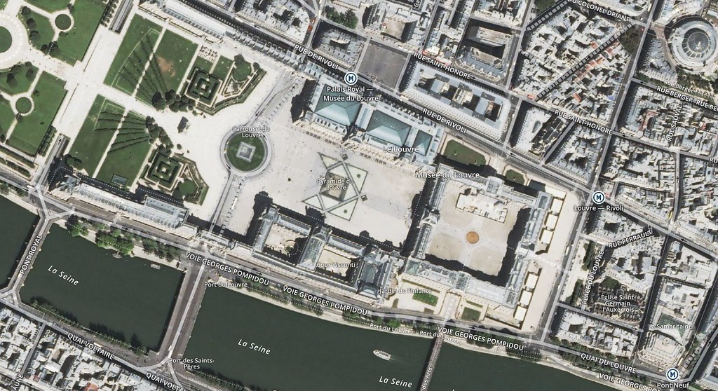
The Louvre in Paris seen in DigitalGlobe’s +VIVID mosaic for Western Europe, with Mapbox Streets labels on top.
Format JPEG JPEG at 70% Filesize 24 KB 16 KB

 Using Mapbox Enterprise as private infrastructure, DigitalGlobe is publishing full globes of their +Vivid imagery and the most current satellite basemaps. DigitalGlobe’s world-class imagery is now available on any device, anywhere in the world.
أكثر...
The Louvre in Paris seen in DigitalGlobe’s +VIVID mosaic for Western Europe, with Mapbox Streets labels on top.
"+Vivid is one of the highest quality imagery products we've ever created and starting today we're using Mapbox APIs to distribute our content and make it simple for anyone to build our images into their apps. Combining the quality of our imagery with the easy-to-use API building blocks that Mapbox provides is a big win for app developers who need the most accurate and up to date location information."
- Jeff Tarr, DigitalGlobe’s CEO
Format JPEG JPEG at 70% Filesize 24 KB 16 KB
أكثر...