LANDSAT 7 +ETM SATELLITE IMAGERY

Satellite Imaging Corporation acquires LANDSAT 7 satellite imagery worldwide.
HISTORY OF LANDSAT 7 +ETM
LANDSAT-1 was the world's first earth observation satellite (EOS), launched by the United States in 1972. It is recognized for its ability to observe the earth far from space. Its excellent set of capabilities emphasized the importance of state-of-the-art remote sensing. Following LANDSAT-1, LANDSAT-2, 3, 4, 5, and 7 were launched. LANDSAT-7 is currently operated as a primary satellite.
LANDSAT-5 was equipped with a multispectral scanner (MSS) and thematic mapper (TM). MSS is an optical sensor designed to observe solar radiation, which is reflected from the Earth's surface in four different spectral bands, using a combination of the optical system and the sensor. TM is a more advanced version of the observation equipment used in the MSS, which observes the Earth's surface in seven spectral bands that range from visible to thermal infrared regions.
LANDSAT SATELLITE SENSOR CHARACTERISTICS
Launch Date 15 April 1999, at Vandenberg Air Force Base in California
Spatial Resolution 30 meters
Orbit 705 +/- 5 km (at the equator) sun-synchronous
Orbit Inclination 98.2 +/- 0.15
Orbit Period 98.9 minutes
Grounding Track Repeat Cycle 16 days (233 orbits)
Resolution 15 to 90 meters
The thematic mapper (TM) is an advanced, multispectral scanning, earth resources sensor designed to achieve higher image resolution, sharper spectral separation, improved geometric fidelity, and greater radiometric accuracy and resolution than that of the MSS sensor. This sensor also images a swath that is 185 km (115 miles) wide, but each pixel in a TM scene represents a 30 m x 30 m ground area, except in the case of the far-infrared band 7, which uses a larger 120 m x 120 m pixel. The TM sensor has seven bands that simultaneously record reflected or emitted radiation from the Earth's surface in the blue-green (band 1), green (band 2), red (band 3), near-infrared (band 4), mid-infrared (bands 5 and 7), and the far-infrared (band 6) portions of the electromagnetic spectrum. TM band 2 can detect green reflectance from healthy vegetation, and band 3 is designed for detecting chlorophyll absorption in vegetation. TM band 4 is ideal for near-infrared reflectance peaks in healthy green vegetation, and for detecting water-land interfaces. TM band 1 can penetrate water for bathymetric (water depth) mapping along coastal areas, and is useful for soil-vegetation differentiation, as well as distinguishing forest types. The two mid-infrared bands on TM are useful for vegetation and soil moisture studies, and discriminating between rock and mineral types. The far-infrared band on TM is designed to assist in thermal mapping, and for soil moisture and vegetation studies.
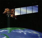
The LANDSAT-7 satellite was successfully launched from Vandenburg Air Force Base on April 15, 1999. LANDSAT-7 is a 5,000 pound-class satellite, designed for a 705 km, sun-synchronous, earth mapping orbit with a 16-day repeat cycle. The payload is a single nadir-pointing instrument, the Enhanced Thematic Mapper Plus (ETM+). S-Band is used for commanding and housekeeping telemetry operations, while X-Band is used for instrument data downlink. A 378 gigabit solid state recorder (SSR) can hold 42 minutes of instrument data and 29 hours of housekeeping telemetry concurrently.
LANDSAT-7 is equipped with Enhanced Thematic Mapper Plus (ETM+), the successor of TM. The observation bands are essentially the same seven bands as TM, and the newly added panchromatic band 8, with a high resolution of 15m was added. An instrument malfunction occurred on May 31, 2003, with the result that all Landsat 7 scenes acquired since July 14, 2003 have been collected in "SLC-off" mode (Details).
Systematic Correction (Level 1G) Gap-filled (SLC-off only) includes radiometric correction, geometric correction, and replacement of all missing image pixels within the SLC-off ("primary") cene with estimated values based on histogram-matched data from one or more user-defined "fill" scenes acquired on a separate date. The image will be rotated and aligned to a user-specified projection. A scan gap mask is included with the final product. All Level 1G SLC-off gap-filled products are processed by the Level 1 Product Generation System (LPGS).
ARCHIVED AND NEW LANDSAT IMAGERY
For many image requests, a matching image can be located in our global archives of LANDSAT 7 imagery. If no image data is available in the archives, new LANDSAT 7 satellite image data can be acquired through a satellite tasking process. Besides providing image data, Satellite Imaging Corporation performs many tasks in the background to ensure that we meet customer specifications and time schedules. We:
Negotiate the attainment of images
Process imagery, including orthorectification, DSMs, DTMs, and raster-to-vector conversions
Provide 3D terrain visualization and modeling for project planning and support
Incorporate third-party USA and international GIS data
Consult on band combinations most appropriate to bring out the geographical and manmade features that are most pertinent to your project
Perform spectral analysis for land cover use classifications and environmental changes
LANDSAT data has been used by government, commercial, industrial, civilian, and educational communities throughout the world. The data is used to support a wide range of applications in such areas as global change research, agriculture, forestry, geology, resource management, geography, mapping, hydrology, and oceanography. The images can be used to map anthropogenic and natural changes on the Earth over periods of several months to two decades. The types of changes that can be identified include agricultural development, deforestation, desertification, natural disasters, urbanization, and the development and degradation of water resources.
For more information and pricing, please contact us.
LANDSAT SATELLITE IMAGERY GALLERY
For LANDSAT sample images, please visit our LANDSAT gallery.
--
