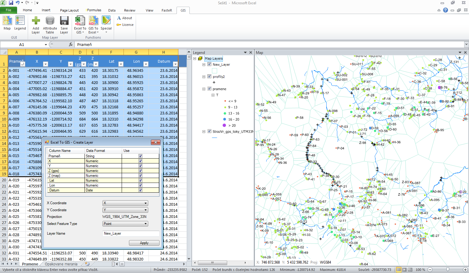
This tool I created in the first step for myself to increase efficiency at work with spatial data. As hydrogeologist I often work with spatial data. If I want to visualize these data, I must always export them to GIS program. These data transfers (between Excel and GIS programs) are not effective or quick. Because I not found existing solution that would suit me, I created this add-in. Later, when my colleagues see the result, they also want to use it. The tool was completed and now it may be using anyone. GIS.XL can be installed on 64-bit as well as on 32-bit computer, and can work in Excel 2005-2013. It needs only Windows OS and does not need any additional external programs or Web service.
From now, you can use GIS.XL too. On monthly basis, you can save hours at work. The greatest benefits of this add-in are:
easy installation
simple and intuitive user interface
no need of additional software or services
variable licensing options
work with ESRI Shape Files
support of multiple mapping projections
quick creation of complex visualization
simple data transfer between Excel tables and ESRI Shape Files
export to Google Earth
export to image files
combining Excel and GIS features
complete story :
http://gisxl.com/Featuresinteresting,
أكثر...