SASPlanet is a program designed for viewing and downloading high-resolution satellite imagery and conventional maps submitted by such services as Google Maps, DigitalGlobe, Kosmosnimki, Yandex.Maps, Yahoo! Maps, VirtualEarth, Gurtam, OpenStreetMap, eAtlas, Genshtab maps, iPhone maps, Navitel maps, Bings Maps (Bird's Eye) etc., but in contrast to all these services all downloaded images will remain on your computer and you will be able to view them, even without connecting to the internet. In addition to the satellite-based maps you can work with the political landscape, combined maps and maps of the Moon and Mars.
أكثر...
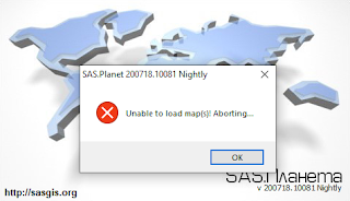
Some sas planet version update have an error like as : unable to load map(s).. So, if you have this message error "unable to load map(s) Aborting" you can use this patch
Download the patch
see how you to add the patch into the correct target
Or you can download the last version from her
Download SAS Planet Nightly All versions 2017-2020
GIS English 2020
Download the patch
see how you to add the patch into the correct target
Or you can download the last version from her
Download SAS Planet Nightly All versions 2017-2020
GIS English 2020
أكثر...